(via: http://www.thingsmagazine.net)
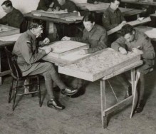
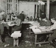
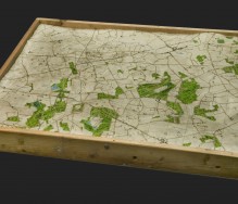
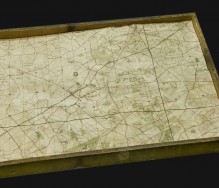
Relief maps made in 1919 in London. They were made in London by men who were still in England, waiting to be repatriated home.
The maps represent the area of Zonnebeke in Flanders field and were used to illustrate the battlefields of France and Belgium during the 1st World War. Apart from the strictly descriptive purposes the land battle, these maps were used to aid the war correspondents in the writing of articles on the exploits of Australian troops in Europe.